.png)
Thailand Weather Alert Heavy Rain and Gusty Winds Threaten Flood Risk Across Key Provinces
Heavy rain over already wet ground can turn a normal storm into a dangerous one quickly. That is the concern behind the latest warning from the Thai Meteorological Department, which has flagged parts of Central, Eastern and Southern Thailand for thunderstorms, gusty winds and isolated heavy rain.
In its 5pm forecast on 16 October, the department warned that accumulated rainfall could increase the risk of flash floods, run-off and landslides, especially in low-lying communities and areas close to foothills and waterways. The alert covers several provinces where repeated rain could leave roads, farmland and homes exposed to sudden flooding.

What the Thai Meteorological Department has warned
The Thai Meteorological Department said unsettled conditions are affecting parts of the country, with thunderstorms, strong winds and heavy rain possible in vulnerable areas. The warning focuses on places where rainfall has already built up, as further downpours can overwhelm drainage systems and natural waterways.
The main risks highlighted are:
Flash floods in low-lying areas where water can rise quickly
Run-off from hillsides and higher ground into communities below
Landslides in areas near foothills, slopes and saturated soil
Gusty winds that may damage light structures, trees and roadside signs
Travel disruption from flooded roads and reduced visibility
The department urged people in at-risk areas to remain alert to changing weather conditions. This matters because tropical storms and localised downpours do not always affect every district in the same way. One area may see only light rain, while a nearby community faces intense rainfall over a short period.
That kind of uneven rainfall is often what makes flash flooding so dangerous. Water can collect upstream, then move rapidly into villages, farms and roads with little warning.
Provinces expected to see heavier impacts
The provinces named as particularly affected include several areas in the Central region and nearby western provinces. These areas should monitor updates closely, especially where communities sit near rivers, canals, foothills or flood-prone roads.
Province | Main concern |
Lop Buri | Thunderstorms and heavy rain in exposed areas |
Saraburi | Run-off risk near foothills and waterways |
Uthai Thani | Accumulated rainfall and local flooding |
Chai Nat | Rising water in low-lying areas |
Suphan Buri | Flood-prone roads and agricultural land |
Phra Nakhon Si Ayutthaya | Drainage pressure in low-lying communities |
Kanchanaburi | Run-off and landslide risk near slopes |
Ratchaburi | Thunderstorms, gusts and local flooding |
Nakhon Pathom | Heavy rain affecting roads and communities |
The warning also refers more broadly to parts of Central, Eastern and Southern Thailand. In the South, heavy rain can be especially concerning in communities close to hills, streams and narrow waterways, where water levels may change fast during prolonged storms.
For the Eastern region, moisture moving in from the sea can help storms build and intensify. Coastal and inland districts may see different conditions, so local alerts remain important.
Why this weather pattern is producing widespread rain
The unsettled weather comes from a mix of seasonal atmospheric conditions. A weak high-pressure system, also described as a cool air mass, is covering the upper North, upper Northeast and the South China Sea. At the same time, easterly and southeasterly winds are carrying moisture from the South China Sea across Thailand and the Gulf of Thailand.
That incoming moisture is helping to feed thunderstorms across the country. When moist air rises, it cools and forms rain clouds. If the air is unstable enough, storms can become stronger, bringing heavier bursts of rain and sharp gusts of wind.
The high-pressure system itself is weak, so it does not bring a clean break in the weather. Instead, it helps shape wind flow and temperature differences while moist air continues to move across the region. The result is a pattern of scattered thunderstorms, with some locations receiving heavier rain than others.
This is why the forecast points to isolated heavy rain rather than constant rain everywhere. Isolated does not mean minor. It means the heaviest downpours may hit specific districts while nearby areas experience lighter showers.
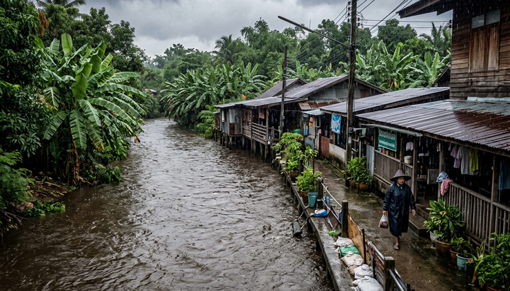
What residents should do before conditions worsen
People in flood-prone areas should prepare early rather than wait for water to rise. Simple steps can reduce danger, especially for households near canals, rivers, hillsides and low roads.
Practical safety steps include:
Monitor official updates
Follow forecasts and local announcements from weather and disaster prevention authorities.
Avoid flooded roads
Water depth can be hard to judge, and fast-moving water can sweep vehicles away.
Move valuables higher
Keep documents, electrical items and essential supplies away from floor level.
Check drainage around the home
Clear leaves and debris from drains where it is safe to do so.
Prepare for power cuts
Charge phones, keep torches ready and avoid using damaged electrical equipment.
Watch hillsides and waterways
Sudden muddy water, cracking ground or unusual sounds near slopes can signal danger.
For drivers, the biggest risks are poor visibility, standing water and fallen branches. Slowing down helps, but the safest choice is to delay travel if storms become intense. Motorcyclists face added danger from slippery roads and wind gusts.
Farmers and outdoor workers should also take gusty winds seriously. Temporary shelters, tools, irrigation equipment and loose materials can become hazards during sudden storms.
Flood and landslide risk depends on local conditions
Rainfall totals matter, but geography matters just as much. A short burst of heavy rain in a steep area can cause faster run-off than longer light rain on flat ground. Soil that is already saturated also has less room to absorb new water.
That means the same storm system can produce different hazards across the country. In low-lying plains, water may collect slowly but linger for longer. Near foothills, it may move quickly and carry debris. Along waterways, levels can rise after rain has already stopped upstream.
Communities that have flooded before should treat this warning seriously. Past flood spots often flood again when drains, canals or natural channels cannot cope with sudden rainfall.
The key message is to stay alert through the full period of unsettled weather, not only during the heaviest downpour. Floodwater can arrive after rain falls elsewhere, and landslide risk may remain when soil is saturated.
A clear takeaway for the days ahead
The latest Thailand weather alert heavy rain warning is a reminder that scattered storms can still bring serious local impacts. The greatest concern is not only rain falling in one place, but rainfall building up over time and moving through waterways, drains and slopes.
People in Lop Buri, Saraburi, Uthai Thani, Chai Nat, Suphan Buri, Phra Nakhon Si Ayutthaya, Kanchanaburi, Ratchaburi, Nakhon Pathom and other vulnerable areas should keep watch on official forecasts, avoid unnecessary travel during severe storms and prepare homes for possible flooding.
Staying ready does not require panic. It means acting early, checking local conditions and giving heavy rain the respect it deserves.



Comments